
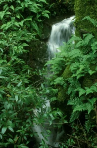
About the Watershed
Table of Contents
Rainfall, Streamflow, and Flooding
Rainfall and Streamflow
The average annual rainfall for the period October 1979 through September 1996 measured by Roy Farrington Jones on Olive Avenue in Ross was 49.33 inches. The lowest rainfall during that period was 28.29 inches in water year 1990 and the highest, 90.75 inches during water year 1983.
Average annual rainfall at the Marin Water gauge at Lake Lagunitas for the period 1875 to 2024 was 52.65 inches. Although this gauge is not within the watershed, it is representative of rainfall in Kentfield, Ross, and San Anselmo. The lowest value during that period was 19.70 inches for water year 1924; the highest, 112.15 inches for water year 1890.
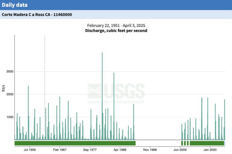
The graph of daily discharge at the Ross Gage, a stream gage just upstream of the Lagunitas Road Bridge in Ross, is displayed below. Between 1951 and 1993, the U.S. Geological Survey maintained the gage. Data from the period 1993–2009 are missing. Marin County began maintaining the gage in 2009. During the entire period from 1951 through 2024, the lowest flows occurred July through September 1977 when the stream was dry. The highest flows occurred in early January 1982, when the peak flow from the creeks was 6000 cubic feet per second. In 2005, the flow was almost as high.
Flooding
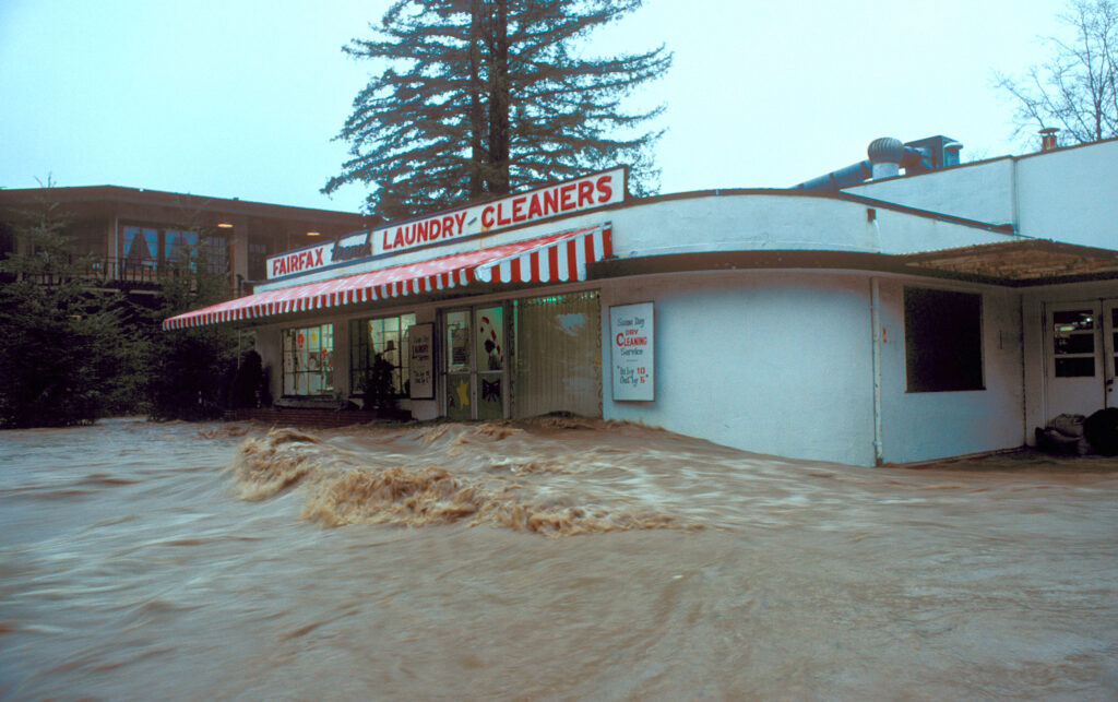
Between 1914 and 1960 there were twelve damaging floods of the valley floor or about one flood every four years. Since 1960 damaging floods have occurred less frequently for several reasons, including better creek maintenance, construction of a concrete channel in Kentfield and Ross, and the fact that 14 out of the 38 years were relatively dry with rainfall between 42% and 75% of the average. Even so, the largest and third largest floods of record occurred during this time, in January 1982 and March 1983. The flood of January 3–5, 1982 was the largest on record and caused considerable damage in San Anselmo, Ross, Kentfield, and Larkspur. Flood water 4 to 5 feet deep flowed down Poplar and Kent avenues with enough force to move cars. On February 2, 1998, just as water began to come out of the channel at the Lagunitas Road bridge and at Granton Park, the rain eased up and the water level dropped. A flood on December 31, 2005 reached levels only slightly below those of the 1982 flood and spurred town and county officials to initiate an ambitious program to reduce future flooding.