
Creek Chronicles
Table of Contents
Creek Chronicles, our biannual newsletter, is another important way we share information. Friends also regularly comments on proposed planning and construction projects that could affect the watershed, advocating for its ecosystem and natural resources.
Download the Current Issue of Creek Chronicles
Selected Articles from Current Issue
Inviting Nature In
by Alycia Matz, 2026
Along Corte Madera Creek near the College of Marin on a rainy April morning, the once-channelized banks of the creek, now restored, are teeming with life. A killdeer, a ground-nesting bird, protects its clutch of three eggs laid close to the newly planted and thriving coast gumplant, as a crow struts nearby in search of breakfast. Cormorants and geese have moved in. Sky lupine, its dainty purple and white blooms already giving way to hairy seed pods, provides pops of ephemeral color. The buckeyes’ palmate leaves have fully unfurled, a vibrant, lively green, putting on a display before they wither away in summer.
These observations suggest that the restoration’s success looks promising. Following the sowing of native seeds and the installation of over 5,800 native plants last fall and winter, there initially had been a waiting period full of anticipation. Would the sown seeds—blue wildrye, California brome, small fescue, common yarrow, and sky lupine—germinate or not? Would the plant plugs receive enough rain throughout the winter to develop strong roots before the dry season commences? Would the plants have an opportunity to mature before wildlife takes advantage of the bounty of food we’ve seemingly provided them?
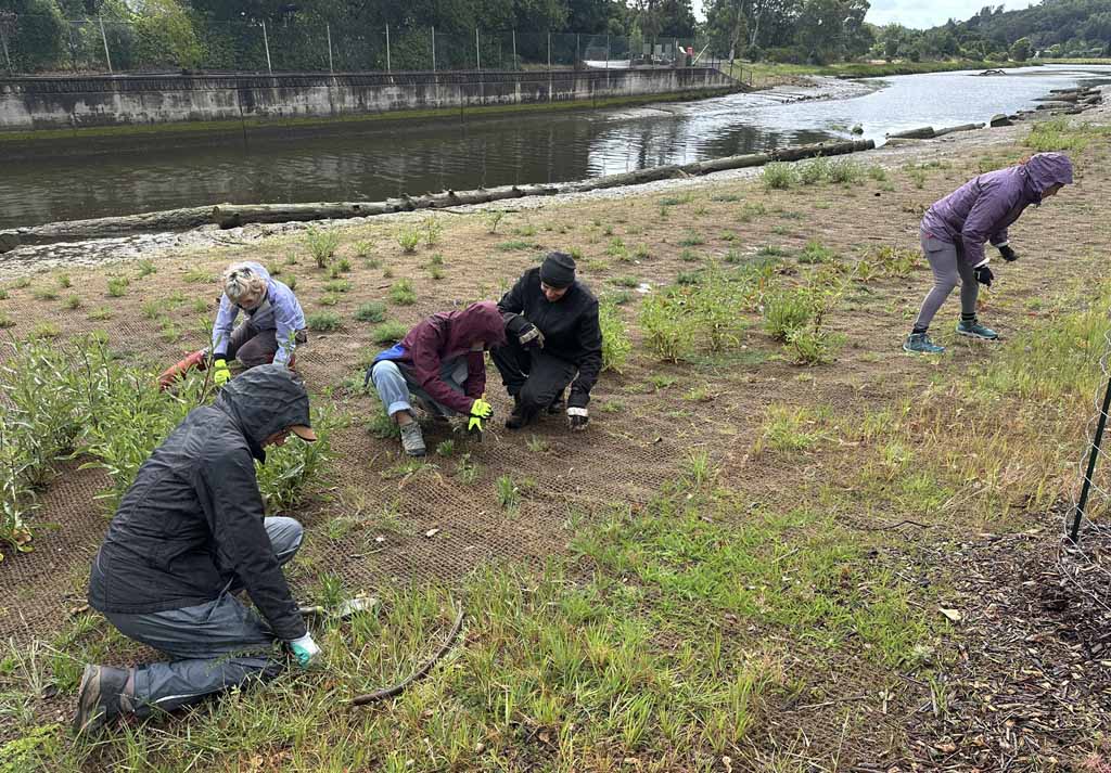
There are only so many factors we can try controlling to achieve the desired outcome of increased native plant cover and its associated benefits: enhanced wildlife habitat, improved water quality, streambank stabilization and reduced flood hazards. We can provide supplementary irrigation to help plants get established, if rain is minimal or if the temperatures are hot—as was the case with the historic heat wave this March. We can place deer caging around select plants, such as oaks and toyons, to protect them from herbivory or damage from burrowing rodents. We can remove invasive weeds adjacent to the native plantings to reduce competition for limited resources of space, water, and nutrients. But otherwise, we have to let time pass and nature do the work of healing itself, before we can know how the new plants will do.
Some of the new native plants make it, and some plants don’t. Green carpets of common yarrow seedlings blanketed what was once bare soil. Some sticky monkeyflowers have doubled or tripled in size, dripping with cheerful, orange blossoms, but unfortunately, most have died. Various ducks feasted on substantially all of the newly planted, nursery-grown pickleweed before it had an opportunity to establish itself. Fortunately, as a pioneer species, there is little doubt that pickleweed will eventually successfully expand across the marsh plain. Canada geese uprooted the newly planted, nursery-grown saltgrass. The Conservation Corps North Bay crew installing the plants was distressed to see their efforts so quickly undone. The old, tough pickleweed salvaged from the work area before construction started was not tempting to the ducks and it is growing. Salvaged saltgrass, jaumea, and bulrush are also doing well. Initially, we thought that the effort to salvage plants was not worth it, but after seeing the depredation on tender nursery-grown plants, we have changed our minds.
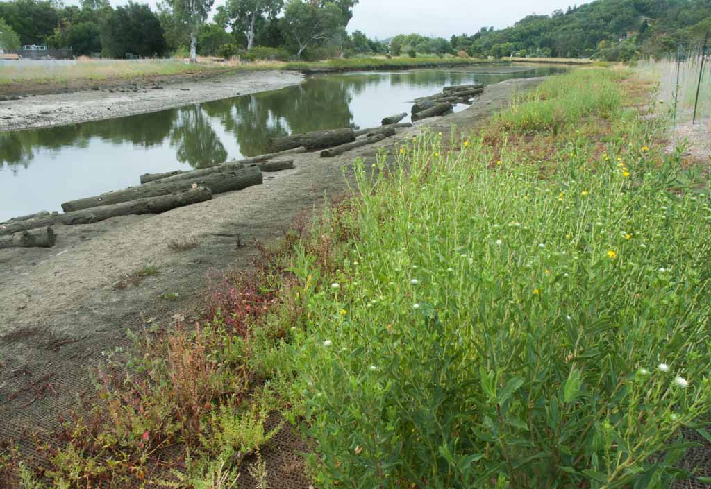
Of course, the other plants out there are the weeds. The weed pressure at new restoration sites can be strong. Introduced, invasive species often grow much more quickly, particularly in areas of recent disturbance, compared to our native plants. Volunteer efforts, such as the weeding day Friends of Corte Madera Creek hosted in April, can give the new plantings the support they need to thrive by providing them more space to grow. Timing the weed removal early, before introduced species like Italian thistle or sweet clover have the opportunity to go to seed, is key. The turnout by community members included many College of Marin students, eager to support their local creek, gain experience, and become the next generation of leaders. An unexpected reminder this day was the need to be ready to adapt as new information is gathered. We noticed at least a half dozen sphinx month caterpillars eating nonnative triangle orache and hyssop loosestrife, and decided to leave these species for the time being and refocus our efforts on removing other nonnative plants.
Time will reveal to us how the native plantings will fare, and continued efforts to provide irrigation and manage weeds will contribute to their overall survival and the success of the project. For now, we celebrate the little wins of nature returning.
How High WIll the Tide Be?
by Nick Salcedo and Sandy Guldman, 2026
We are all familiar with the tide tables prepared by the National Oceanic and Atmospheric Administration (NOAA) available on-line and in various fishing guides and local news outlets. These tables, known as astronomical tidal predictions, can be prepared years in advance because they are based on the predictable movements of the sun, moon, and Earth. In most locations, there are two tidal cycles per day: two high tides and two low tides. The relative distances and positions of the sun, moon and Earth all affect the size and magnitude of the ocean’s two tidal bulges.
Astronomical tides are caused by the gravitational pull of the sun and the moon, and they have their greatest effects on tides during new and full moons—when the sun, moon, and Earth are in alignment. As a result, the highest observed tides often occur during storms that coincide with a new or full moon.
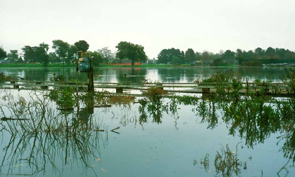
The predicted tide heights (astronomical tidal predictions) are measured from a ‘tidal datum,’ an elevation used as a zero reference to measure local water levels, heights, and depths. These datums are established by averaging specific tide phases (e.g., high or low tides) observed over an approximately 19-year astronomical tidal cycle—the National Tidal Datum Epoch (NTDE)—that is used to calculate datums like Mean Sea Level (MSL) and Mean Lower Low Water (MLLW).
In San Francisco Bay, sea levels have risen about three inches since the 1990s, so current predicted tides start off three inches too low. New, updated tidal prediction tables are officially projected for release in 2029, using the 2002–2020 epoch.
The most common datum used for nautical applications is MLLW. For land-based applications, the geodetic North American Vertical Datum of 1988 (NAVD 88), a leveling network for North America relative to a single point in Quebec is the current standard. While close, these datums differ by a few inches (depending on the location), the latter trending toward a higher mark. Other datums include Mean Higher High Water (MHHW), Highest Astronomical Tide (HAT), Max Tide (Highest Observed Tide), Lowest Astronomical Tide (LAT), and Min Tide (Lowest Observed Tide). For nautical applications, MLLW is the most common standard, followed by MHHW.Tidal predictions are based on models, and although they are continually improving, they are not reality. Reality is recorded as Observed Water Levels. Many NOAA tide stations show both predicted levels and observed levels, including the San Francisco Station 9414290.
Tidal predictions for locations without tide stations are extrapolated, meaning that data from existing tide stations are used to make an educated guess that the pattern will replicate in other locations. Although NOAA has a Corte Madera Creek tide station (9414874), it has not been in service since 1978. So any website that publishes tidal data for Corte Madera Creek is using extrapolated data. In spite of that limitation, there is a wealth of good information about Corte Madera Creek’s predicted tidal information on several websites.What follows are a number of meteorological, hydrologic, and/or oceanographic forces that influence tidal water levels that may not be captured in the periodic astronomical tidal models.
Seafloor Topography and Water Depth The magnitude of tides can be strongly influenced by the shape of the shoreline. NOAA uses a numerical model that includes high-resolution digital elevation models of the Bay’s bathymetry to simulate tidal movements, amplification, and phase differences. Yet, the models do not account for periodic changes in sediment distribution.
Barometric Pressure High-pressure systems can depress sea levels, with clear sunny days coinciding with exceptionally low tides. Conversely, low-pressure systems contribute to cloudy, rainy conditions typically associated with tides much higher than predicted. During the exceptionally high tides on January 3, 2026, the barometric pressure was slightly below average, contributing about 0.4 in to an observed tide of 8.3 ft, when 7.2 ft was predicted.
Wind and Storm Surges Another rise in sea surface level occurs during a storm. It is caused primarily by winds from an incoming storm pushing ocean water onshore. The amplitude of the storm surge at any given location depends on the orientation of the coast line relative to the storm track, the intensity, size, and speed of the storm, and local bathymetry. Therefore, storm tide is the observed water level during a storm, a combination of storm surge and the astronomical tide.
Temperature and Rainfall Water expands when it warms, so warmer water will result in higher water surface levels. Additional water from rainfall also raises water surface levels. Rainfall impacts are most notable close to shore, and in estuaries, where a creek or river enters a water body that is subject to the tides.
The consensus of weather experts in the Bay Area is that the very high tides of early January 2026 were mostly the result of storm surge. Fortunately, the storms producing the surge did not bring significant rainfall and therefore did not add a large amount of storm water runoff to the otherwise already damaging tidal flood waters.
All the above—improved models, more and current data—are bound to improve tidal predictions. But maybe even more important will be the update of the National Tidal Datum Epoch. NOAA is currently updating the NTDE for the entire U.S., including San Francisco Bay.
The upcoming change will replace the current 1983–2001 epoch with a new 2002–2020 epoch. Updated figures are projected for release in 2029. These updates are done every 20–25 years to account for long-term sea level rise and land movement. NOAA is currently advising engineers, planners, and coastal managers to use this interim period to review their projects and plans, and be ready to incorporate future updates.While we wait for 2029, we can look to the past 10-plus years when the anticipated increases in tidal water levels in San Francisco Bay were extensively studied. The results are published in the San Francisco Bay Tidal Datums and Extreme Tides Study. This comprehensive study updates tidal datums and extreme tide estimates for San Francisco Bay to support flood management, shoreline planning, ecological studies, and sea level rise adaptation. It notes that data collection and modeling capabilities have significantly improved, and that longer and more detailed datasets now support better understanding of hydrodynamics. It also recognizes and does its best to incorporate the Bay’s complex interactions of bathymetry, hydrodynamics, and astronomical tides that drive tidal water levels.
The report, and its appendices, include calculated extreme tide levels based on future sea level rise, with projections of six inches (most likely) to 12 inches (upper range) rise by 2030. It also estimates up to 36 inches (most likely) to 66 inches (upper range) increases by 2100. MarinMap has a Marin Sea Level Rise Viewer app where one can visualize these forecasts. A five-foot increase in tidal water level would be devastating for low lying areas in Corte Madera and Larkspur, but areas upstream of the College Ave. bridge in Kentfield appear to be unaffected.
King Tides, scientifically known as perigean spring tides, are naturally occurring phenomena. They happen when the Earth, moon, and sun align during a new or full moon and while the moon is at its closest point to Earth (perigee) and the Earth is closest to the Sun. This perfect alignment creates an extra strong gravitational pull on the oceans. The term “king tides” was popularized about 15 years ago, in part to engage public awareness of rising sea level.
The California King Tides Project, a partnership of state, federal, and non-profit organizations, helps one visualize future sea level by observing the highest tides of today. Check their website later this summer for tentative 2026/27 King Tide dates and how you can help participate in data collection.
El Niño and La Niña El Niño, a warming of the Pacific Ocean, and La Niña, a cooling of the ocean, are natural patterns that come and go every two to seven years. The forecast is that this year’s El Niño could be one of the strongest on record, and give Bay Area residents a preview of what life on the coast will be like in a decade or two if global warming continues at its current pace.
Daniel Swain, a climate scientist with UC Agriculture and Natural Resources, said this year’s “Super El Niño” will result in a temporary sea level rise of around six inches in California, and one has to add that number to climate change-caused sea level rise, which—depending on where you are in California—ranges from about six inches to a foot over the past century.
Bay Area residents should expect “significant implications for coastal flooding [and] for wind and surf damage along the coast,” Swain said, pointing to the large wave events in Santa Cruz and the king tide flooding in Marin last year as examples of what may be in store.
Be sure to check the California King Tides Project later for the predicted perigean spring tides for this coming winter and spring. Then, closer to those dates, monitor the latest weather forecasts to see if the tides on these dates will be affected by the several other factors discussed above that also influence tidal water surface levels. You can check NOAA’s San Francisco tide station to see how close the predicted tides were to the observed tides. They may be close, but if there is a significant storm in the vicinity, they are unlikely to be the same!
The Crown of King Mountain
by Ann Thomas, 2026
The entire 292 acres of King Mountain in unincorporated Kentfield and Larkspur will finally be public open space this month. The purchase, following decades of community efforts, has been capped by the purchase in June of its 161-acre summit. The purchase is fully funded by the Shelby Cullen Davis Charitable Fund, a private philanthropic Delaware-based foundation.
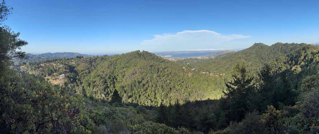
King Mountain, a foothill of Mount Tamalpais, rises as a scenic backdrop to the City of Larkspur, nestled between Baltimore Canyon and Kent Woodlands. It has extensive woodlands of redwood, bay, Douglas-fir, and coast live oak. King Mountain Creek, on the north side, drains into Corte Madera Creek.
Since the mid-20th century, the mountain has attracted and withstood several efforts at development. According to Larkspur: Past and Present, in 1972, the then-owner Tiscornia Estate Company proposed grading 360,000 cubic yards off the top of part of the mountain to fill low-lying land at the intersection of Magnolia Avenue and Bon Air Road for development. The project was stopped by Larkspur. In 1985, when the city undertook a planning study for the mountain acreage within Larkspur, a community group, galvanized by resident David Moller, formed the King Mountain Open Space Association to promote acquisition of the mountain for open space.
According to Moller’s 2021 Brief History of King Mountain, the community efforts resulted a deal in which the 131 acres in Larkspur’s jurisdiction were purchased by Marin County Open Space District and the summit remained in private ownership but with a scenic and trail easement encumbering 129 acres of the site. Thirty-two acres at the summit of the 760-foot mountain remained available for development and went through various project proposals. The summit property has been on Marin County Parks’ wish list for decades but the price was always beyond county resources.
The property was acquired by Genentech cofounder Herb Boyer who obtained vesting approval for a more than 20,000 square-foot compound with a main residence, caretaker’s home, auxiliary buildings, along with other infrastructure on the 32-acre summit. This project was never built and the property was acquired by Mettalica musician Lars Ulrich in 2015. Mr. Ulrich tried to sell it for several years, but had no takers.
This spring the Shelby Cullen Davis Charitable Fund notified Marin County Parks of its interest in funding purchase of this property for open space. Marin Open Space Trust (MOST), at the County’s request, worked with the Foundation to negotiate the purchase. When escrow closes and MOST receives the property it will be simultaneously transferred to Marin County.
The Foundation has also provided a $2 million stewardship fund for the site and county parks staff are already planning to quickly remove the chain link fence that blocks entry to the summit, add picnic tables and signage, and begin extensive cleanup of the site and removal of extensive stands of fire-prone broom.