
About the Watershed
Watershed Maps
The watershed is located north of San Francisco in the eastern portion of Marin County, west of San Pablo Bay.
Watershed and Subwatershed Maps
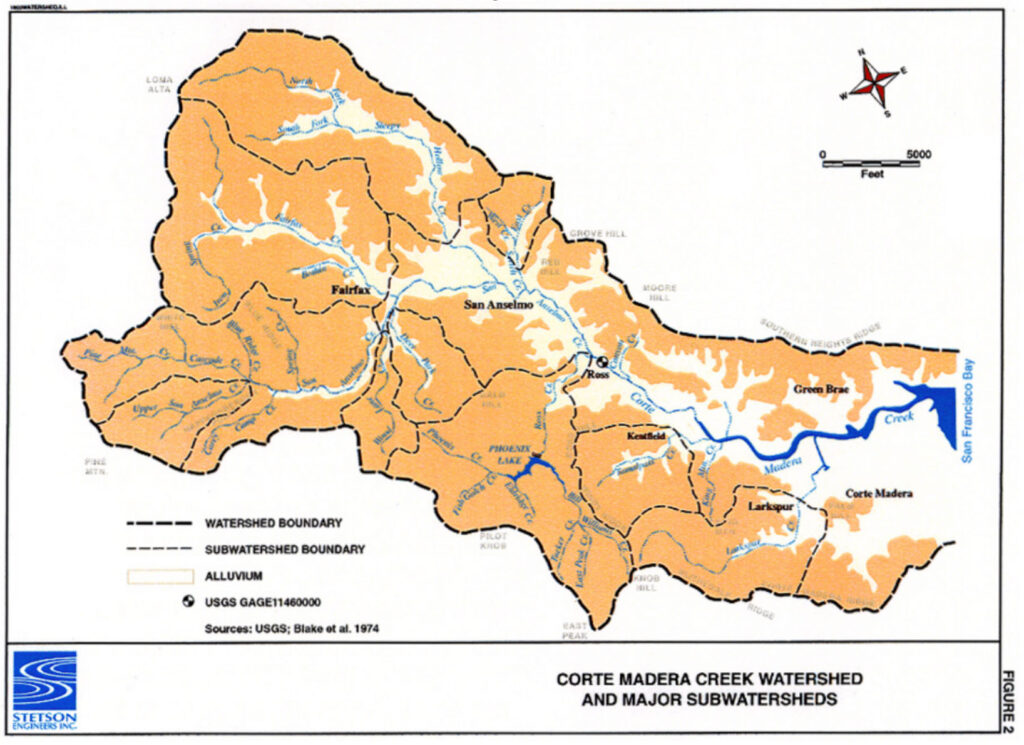
Although our watershed is named for Corte Madera Creek, which connects to San Francisco Bay, there are several important named tributaries shown on the Watershed and Subwatershed Map. The watershed features map shows some important features: barriers to fish passage, some notable redwood groves, and the locations of our habitat projects. Broad categories of imperviousness are shown on the Ross-Valley-imperviousness-map.
Communities and Public Lands in the Watershed
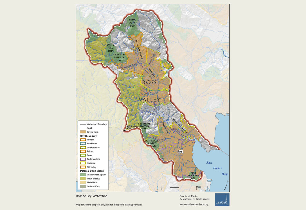
Our watershed includes land under the jurisdiction of nine entities:
- Four incorporated towns–Fairfax, San Anselmo, Ross, and Corte Madera
- One city, Larkspur
- Unincorporated communities of Sleepy Hollow, Kentfield and portions of Greenbrae that are governed by Marin County
- Five special districts–Marin County Water Conservation and Flood Control District; Marin County Parks; Golden Gate Bridge, Highway and Transportation District; Marin Water; and Ross Valley Sanitary District
- Mount Tamalpais State Park.
Ross-Valley-jurisdictions-map.pdf
3-D Relief Map
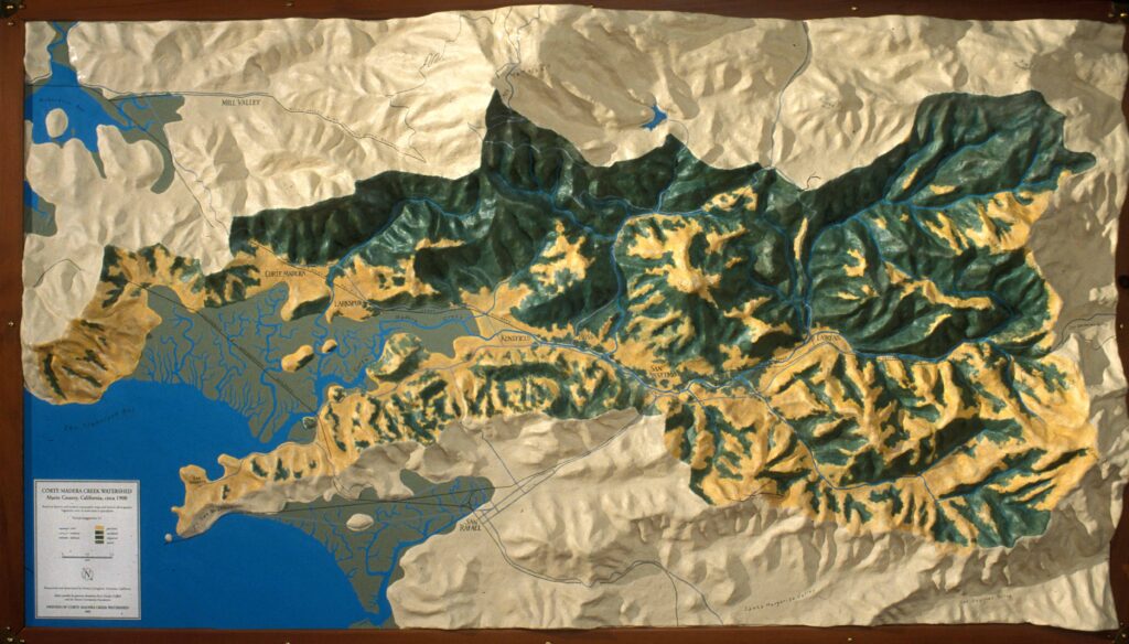
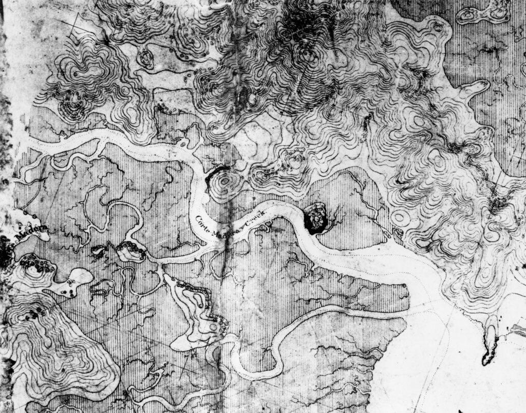
A relief map of Corte Madera Creek watershed showing how the area looked about 150 years ago provides a view from on high. This relief map, expertly made and painted by Dewey Livingstone, through the generosity of Glenda Griffith, gives one a birds’ eye view of what the Ross Valley looked like before it was built out. In place of the familiar scenes of houses and shops, roads and parking lots, this model takes us back to the relatively natural valley. Where houses now stand beside the confined creek, you can see the original wetlands, home not to humans but to wild creatures of every kind: birds, fish, otters, and anything that wriggles in the fertile mud. The creek itself meanders lazily in a wider, shallower bed, with room to spread out during high winter flows, but with tree-shaded, snag-rich summer pools sustaining populations of fish now vanished, sacrificed to not-very-successful efforts to eliminate winter floods in the strait jacketed stream we know today. Looking at the way Nature let the creek flow in the past is not just a nostalgia trip. Seeing how the various components of the natural world developed and co-existed comfortably can give us some suggestions for the future. We can see how the landscape shapes the present Corte Madera Creek as it runs through the watershed and better understand the forces shaping the creek. Studying how the creek used to be can help us find better ways for the creek and all its neighbors–humans, plants and animals–to live together in harmony.
This beautiful and evocative model of Corte Madera Creek watershed is currently stored at the College of Marin Science Museum. The map can be hung on the wall or placed in a case. If wall-hung, the map has a horizontal orientation, 62 inches wide by 36 inches high; the relief sculpting protrudes about 10 inches from the wall. The map weighs about the same as a framed painting, so two large picture hooks will support it. To visit it or arrange to display it in a classroom or at a meeting, contact Sandy Guldman, info@friendsofcortemaderacreek.org or 415-456-5052.